

Hydro GeoAnalyst
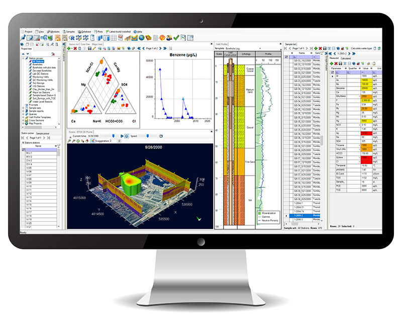
Hydro GeoAnalyst (HGA) is the comprehensive and easy-to-use environmental data management system. HGA integrates customizable database structures used around the world with state-of-the-art tools for data interpretation, statistical analysis, Geographical Information System (GIS) mapping, data charting, and visualizations in two or three dimensions.
With Hydro GeoAnalyst, environmental professionals, geoscientists and government agencies have all the tools required to effectively and efficiently manage large volumes of data, and make informed decisions about environmental and water resources.
HGA consists of an application that connects to an SQL Server database and facilitates data management, analysis and interpretation, and collaboration through various purpose-built modules. HGA helps you work with large volumes of environmental data without requiring in-depth knowledge of SQL. HGA+ extends these capabilities by adding modules specifically designed to work with geochemical data and a console for use R to get even more out of your data.
Hydro GeoAnalyst Applications Include:
- Manage data for local, state and federal groundwater monitoring networks
- Analyze borehole data acquired for mineral exploration
- Manage well construction details and registration information
- Manage data associated with remediation projects
- Store and report landfill monitoring data, groundwater vulnerability assessment and protection planning
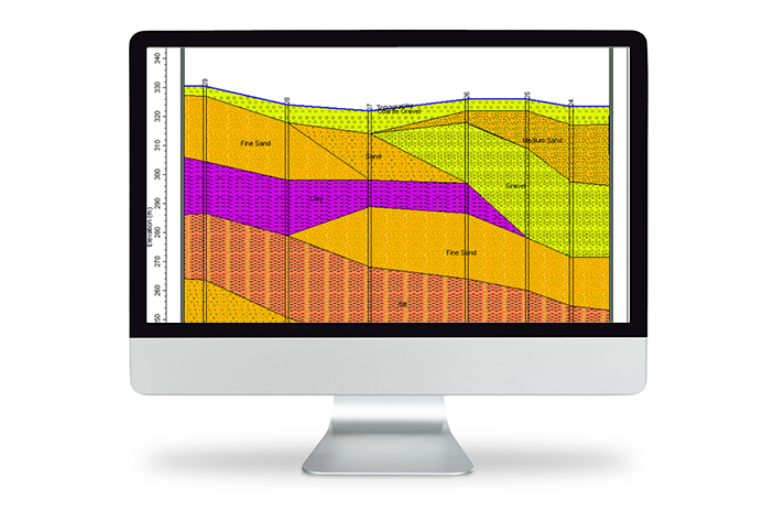
- Mapping and reporting of aquifer extents and geologic formations
- Evaluate and report the spatial distribution of water quality parameters